Lidar (also written LIDAR, LiDAR or LADAR) is a remote sensing technology that measures distance by illuminating a target with a laser and analysing the reflected light. Typically, an aircraft overflies the area of interest and captures distance-to-ground data in a grid pattern where the grid consists of cells of side 2 metres. Various techniques enable “above ground” objects such as buildings and trees to be removed, meaning that a near true representation of the ground surface is obtained.
Lidar is popularly used as a technology to make high-resolution maps, with applications in geomatics, archaeology, geography, geology, geomorphology, seismology, forestry, remote sensing, atmospheric physics, airborne laser swath mapping (ALSM), laser altimetry, and contour mapping.
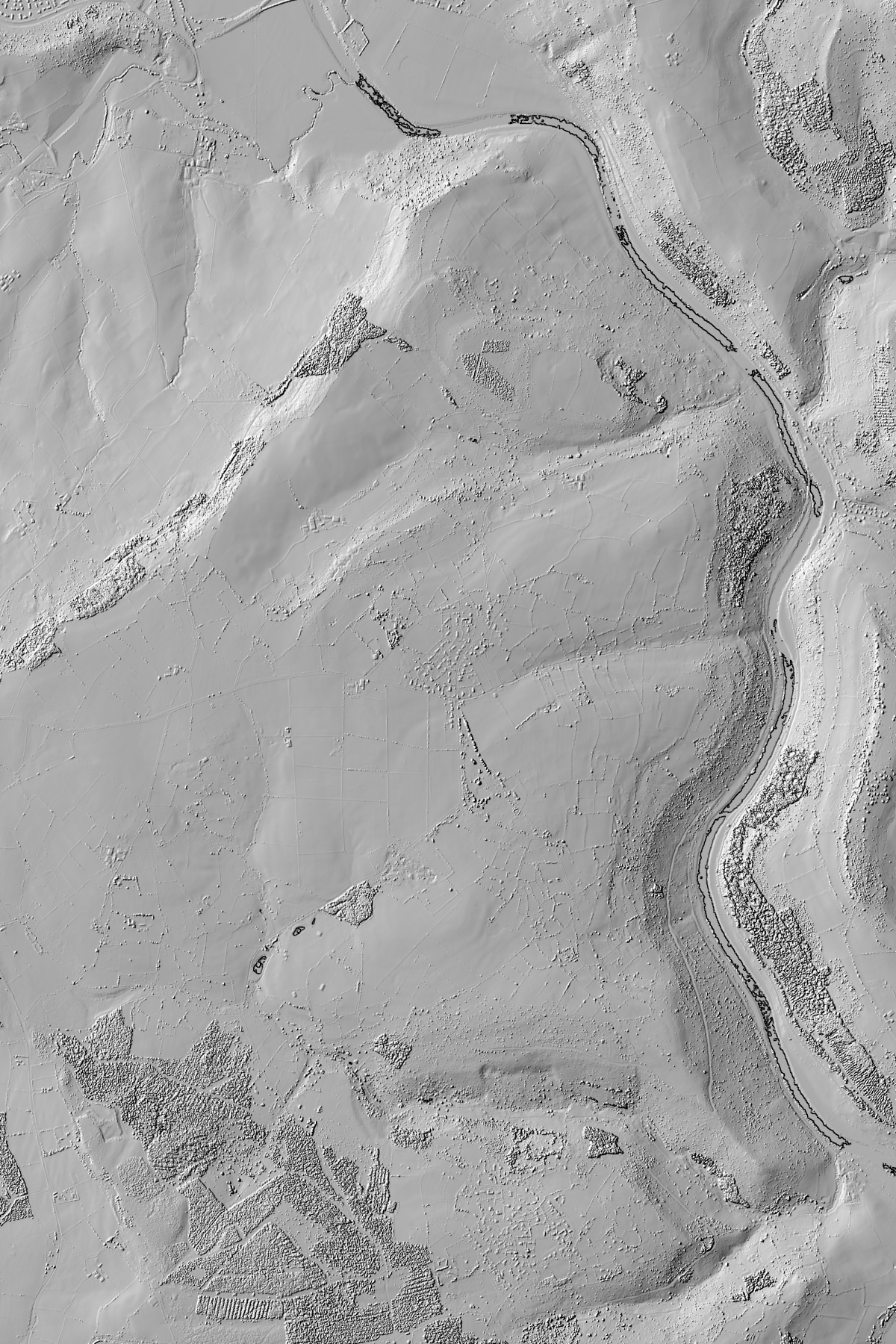
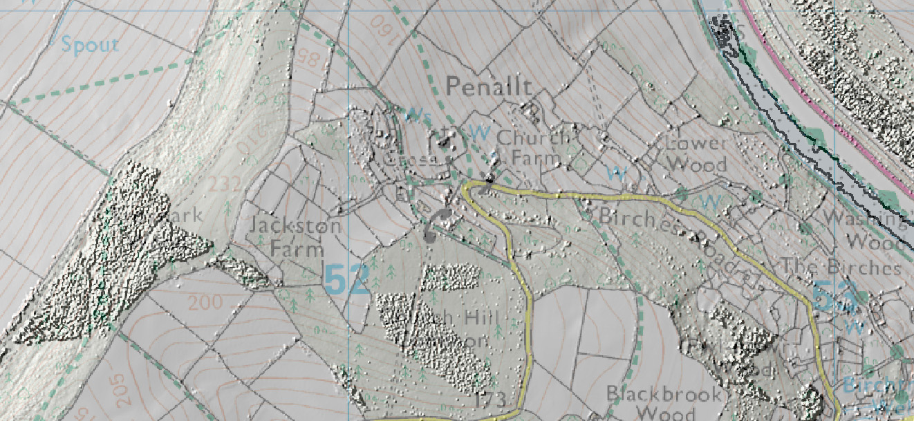
The Penallt History Society recently obtained data for the Penallt area, and Cindy Holton showed some results of the subsequent analysis of the data to the meeting on Thursday 19th March 2015. There was so much interest in the images shown that we have now made them available for all to inspect at their leisure.
In order, from left to right, the images are:-
- A whole area terrain model using the default ‘lighting’..
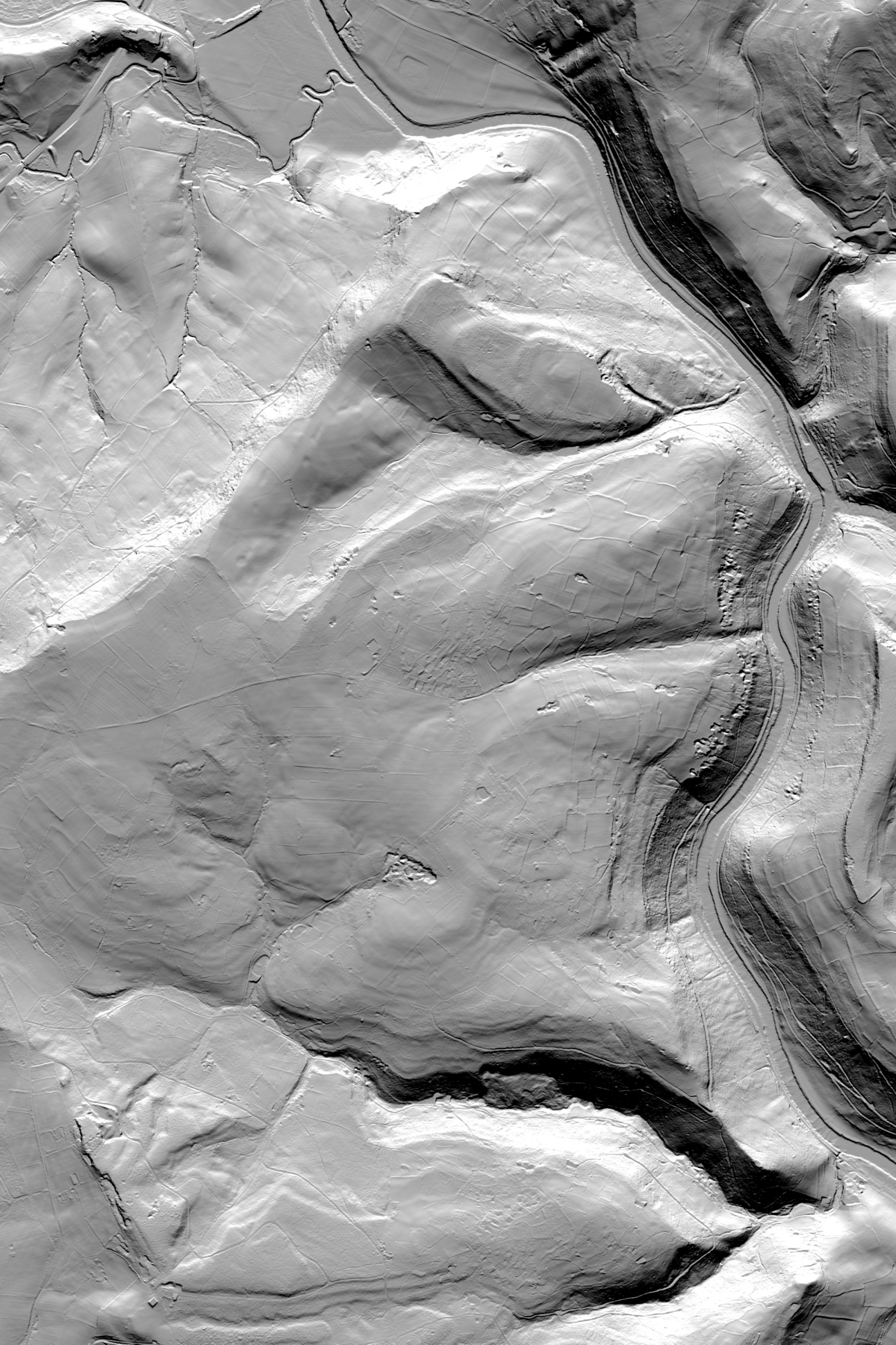
- This is the same as the first image, but with the sun moved around a bit. It is
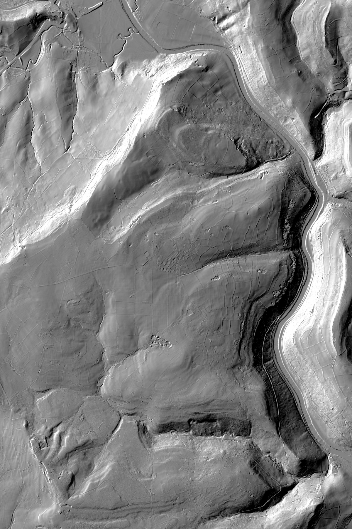
designed to show how different features could be highlighted by playing with the angle and height of the sun – ie light source. For both images the height element of the terrain has been exaggerated to help emphasise ground features. - This is a whole area Surface model, showing buildings and vegetation rather
than bare terrain - Part of the surface model with OS data overlaid
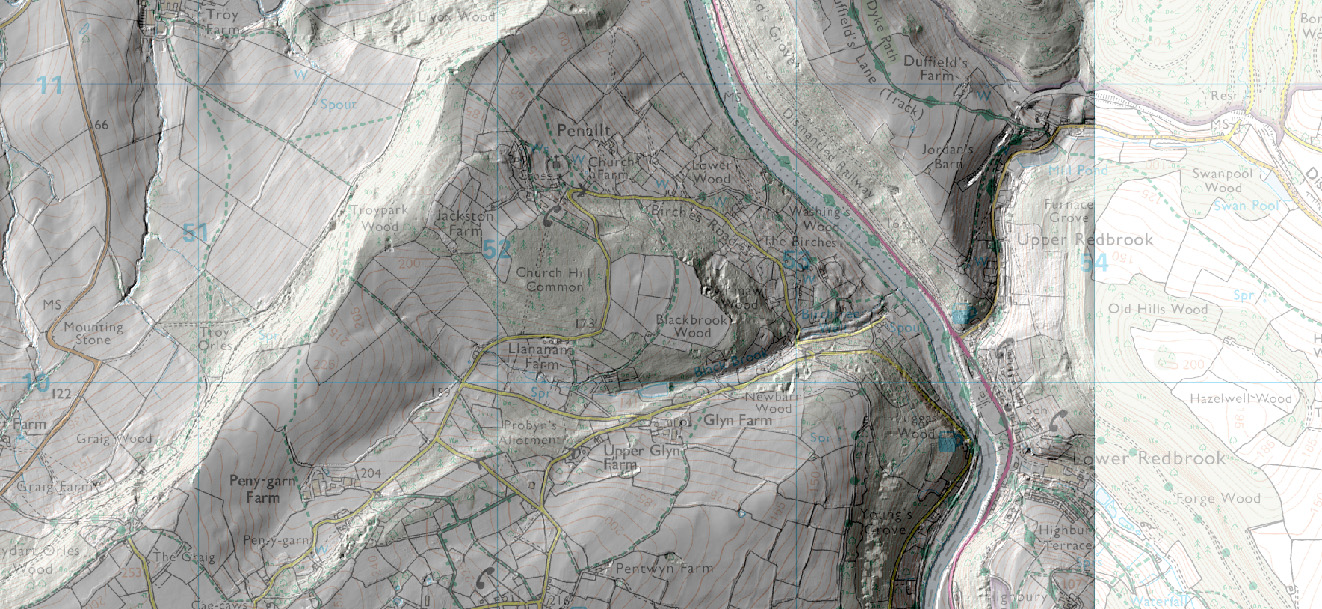
- This is part of the terrain model with OS 1:25,000 map overlaid
Click a link above to open the full-size maximum resolution version of the image. This can then be downloaded and saved if required.